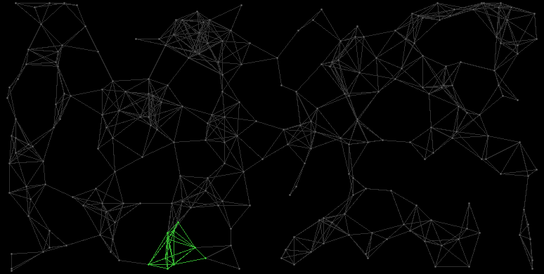
General description
The Iron Stars consists of the systems Biarge, Onusorle, Quzadi, Aona, Entizadi, Cetiisqu, Leleer, Usrarema, Qucerere, and Rabedira.
Map
Systems
| ID |
Name |
HC |
Position |
Gov. |
Eco. |
TL |
Prod. |
Pop. |
Inhabitants
|
| 0031:3
|
Biarge
|
7
|
(83,208)
|
2
|
0
|
12
|
002256022560 MCr
|
4.7 Bln.
|
Human Colonials
|
| 1281:128
|
Onusorle
|
9
|
(81,216)
|
1
|
2
|
08
|
001024010240 MCr
|
3.2 Bln.
|
Human Colonials
|
| 0941:94
|
Quzadi
|
11
|
(78,219)
|
4
|
3
|
09
|
001792017920 MCr
|
4.0 Bln.
|
Human Colonials
|
| 1531:153
|
Aona
|
10
|
(78,224)
|
5
|
0
|
13
|
003888038880 MCr
|
5.4 Bln.
|
Human Colonials
|
| 1321:132
|
Entizadi
|
9
|
(91,233)
|
4
|
1
|
12
|
002880028800 MCr
|
5.0 Bln.
|
Human Colonials
|
| 2341:234
|
Cetiisqu
|
4
|
(96,242)
|
1
|
2
|
07
|
00089608960 MCr
|
2.8 Bln.
|
Human Colonials
|
| 0021:2
|
Leleer
|
7
|
(77,243)
|
3
|
3
|
08
|
001372013720 MCr
|
3.5 Bln.
|
Human Colonials
|
| 1461:146
|
Usrarema
|
8
|
(81,249)
|
7
|
1
|
12
|
004197641976 MCr
|
5.3 Bln.
|
Small Black Slimy Rodents
|
| 1961:196
|
Qucerere
|
6
|
(78,252)
|
4
|
4
|
08
|
001420814208 MCr
|
3.7 Bln.
|
Human Colonials
|
| 0061:6
|
Rabedira
|
6
|
(69,249)
|
2
|
1
|
09
|
001555215552 MCr
|
3.6 Bln.
|
Human Colonials
|

